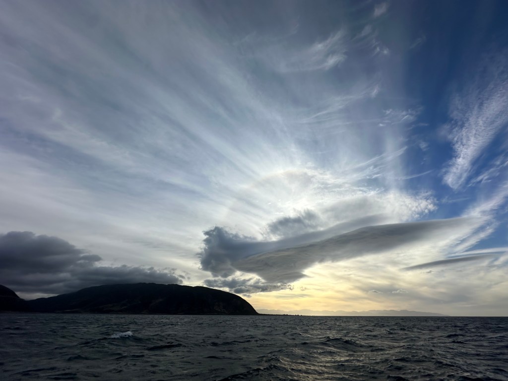
Sailing from Wellington to Tauranga involves travelling some 440 nautical miles, or 815 kms, up the east coast of New Zealand’s North Island. The journey passes through some notorious stretches of water, the Cook Strait, Castle Point, and East Cape. Part of this notoriety is due to the fact that once the trip is underway there are few places to seek shelter. Napier is one option, indeed we ended up being storm bound in Napier for ten days when we sailed Taurus south after our initial purchase, but this involves a pretty major detour into Hawkes Bay; Gisborne is another, but doesn’t really cater for yachts; and after that there are a few rolly anchorages before East Cape, but the safety of these are very dependent on wind strength and direction.
As we plan our passages using an average speed of 5 knots, 9 km/h, we were looking for a window that offered good weather for 3.5 days. Looking ahead we saw strong NW wind predicted in the Cook Strait on the Monday coming, followed by a week of northerlies which would blow right onto our nose and preclude our leaving. Sunday, however, looked like a good option, with westerly winds turning into light southerlies — provided we outran the gale predicted for Cook Strait and the area slightly north of it which was due the following day. We checked and rechecked our timings in the context of expected distance travelled and weather forecast in the area at that time, and made the decision to go.
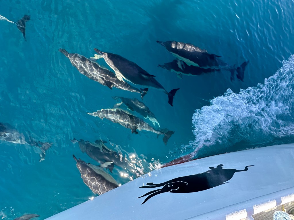
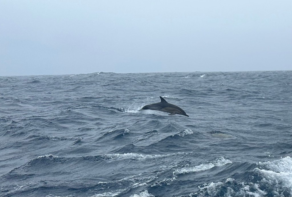
We left Wellington with a hiss and a roar. Thirty knot winds and a strong current thrust us out of the harbour entrance at a rate of knots and we made great time for a couple of hours before the wind disappeared. The engine then came on and we kept pushing east to make sure that we weren’t caught out in the gale due on Monday. The light winds persisted all day and we passed Cape Palliser in a flat calm. A large pod of dolphins who joined us to play in the clear waters at Taurus’ bow provided the highlight of the day.
We plugged along, turning north after Cape Palliser, and were pleased to be making ground, though disappointed not to be able to sail as the favourable winds predicted had failed to arrive. It came as something of a shock to later realise that the forecast for the area between Castle Point and Cape Turnagain had changed during the day from 20 knots to 40 knots. We would not willingly have put ourselves in this area in such winds, which could be expected to provide gusts of up to 60 knots. The Beaufort Scale categorises wind speeds of 48-55 knots as Force 10 (on a scale that ends at 12) and calls such weather a ‘storm’ or ‘whole gale.’
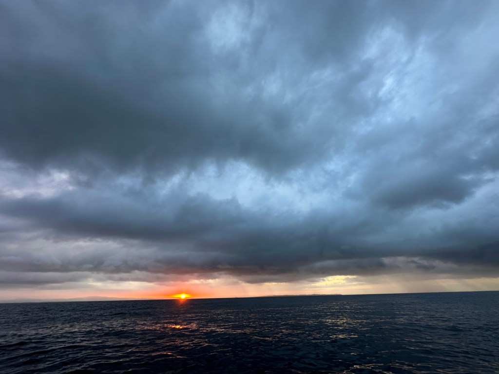
Considering our options we were pretty much stuck between the devil and the deep blue sea, as the saying goes. We had nowhere to run to; we couldn’t turn around due to the gale about to hit the Cook Strait, so continuing north seemed about as good an option as any other. One bright side was that at least the winds were predicted to be westerly, so we would be pushed away from land rather than having a dangerous lee shore to worry about too. If they had been easterly I think we would have had to run off-shore to get as much space as possible between us and the coast. That evening the continuing flat calm seemed to mock our fears. It was hard to imagine strong winds just a few hours away.

Modern technology can be a double edged sword. A weather routing app we frequently use has a function that allows you to see real-time weather conditions at prefixed points. As we continued to motor north we were able to watch the winds rising at Castle Point and Cape Turnagain until they were regularly recording 40 knots with 50 knot gusts. A 15 knot westerly had risen which allowed us to sail, if slowly as we were naturally reluctant to have much very much sail up in case the strong winds only a few miles away caught us out. This situation persisted until we found ourselves past Castle Point. We knew that the weather station on the coast was recording 40-60 knots (highest gust recorded was 58 knots) but we were sailing in winds of about 25-35. Looking at the various meteorological office forecasts we noticed that several appeared to show a corridor of lighter winds that ran parallel to the coast. I have no idea how this should work, but the winds we experienced were far lighter than those recorded on land. As we came to the entrance to Hawkes Bay we decided to keep going rather than heading in to Napier, and try to make the most of the window we had seen and planned to take advantage of.

The journey continued smoothly with light winds demanding a certain amount of motoring or motor sailing. Travelling around East Cape provided some of the best sailing of the trip. Smooth seas and a decent 15 knot breeze made a welcome change to the bumpy waves and light zephyrs that had marked a good deal of the passage. A pod of dolphins joined us yet again — this group entertaining us by leaping from the waves.
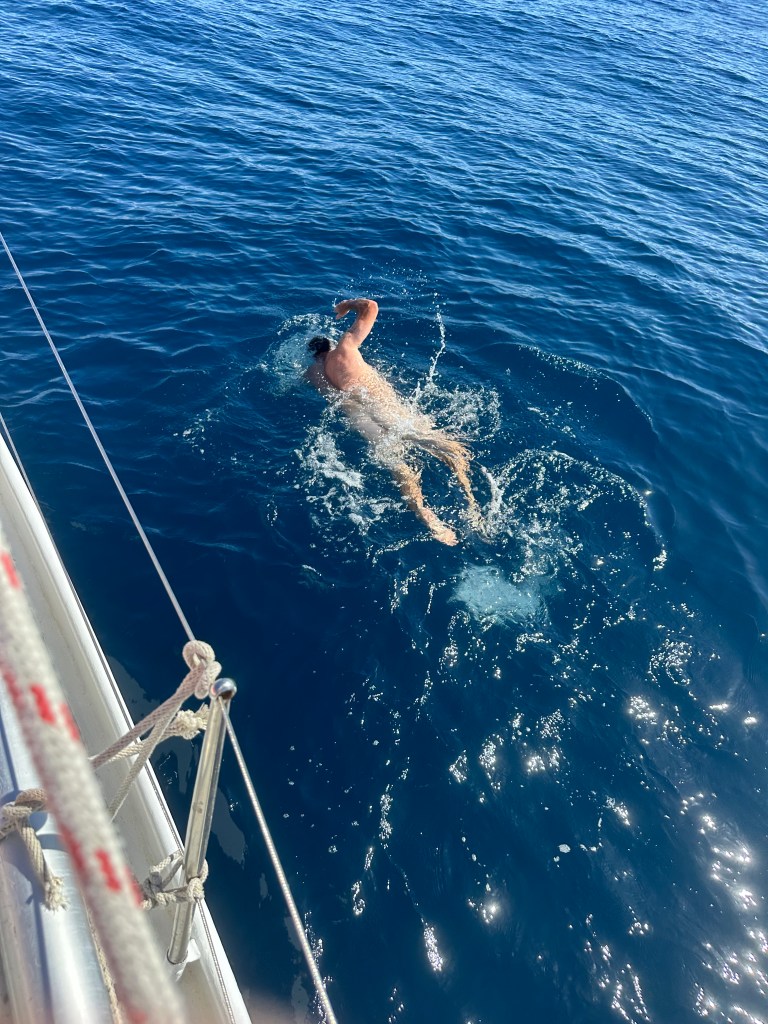
All too soon the wind died again and we were facing another stretch of extended motoring. It was stinking hot and having been travelling for three days at this point we were feeling a bit ‘sticky.’ The sea looked oh so inviting so we threw on our togs (at least Cara did) and dived in. Being used to Dunedin temperatures the sea felt like a warm bath, and allowed us to stretch our muscles.

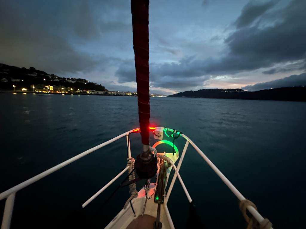
After a quick swim we climbed back onboard and sought to make further headway. Our estimated time of arrival at Tauranga was about midnight, and we had no great desire to enter a busy port at night. The guiding lights that mark channels, red on the left when entering, green on the right, flash at different intervals and have a cyclical period of time in which they go unlit. Each pile’s flash sequence is unique so that it can be identified on the chart. However, in reality what this can mean is that in the pitch dark the tired mariner is faced with a confusing mass of lights: sometimes on, sometimes off, so that it becomes difficult to know which light is closest, and which light you should be guided by. In the past we have found that the best solution is to closely monitor and trust the chart plotter — essentially ‘flying’ the boat by its instruments — as what you see quickly becomes confusing and disorientating.
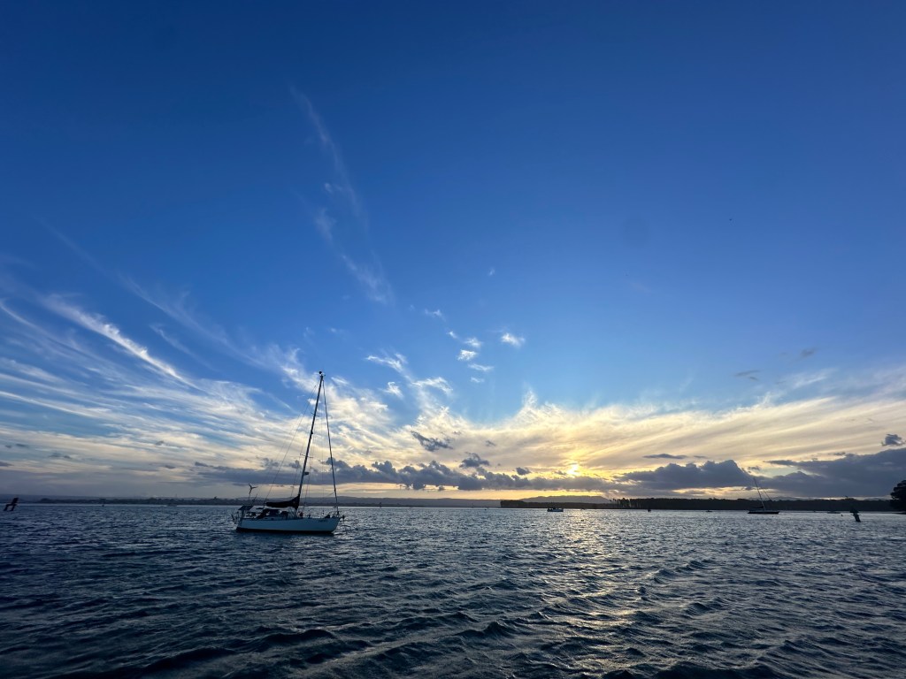
We checked the local cruising guide and found a recommended anchorage in a bay at Motiti Island. Arriving just after dark we slowly motored in, very conscious of the rocks all around us that we couldn’t see. Our ground tackle (anchor and chain) had proven itself to be very reliable, but here we found the anchor dragged for some distance before it ‘grabbed’. The distance we travelled left us slightly exposed, but the weather was supposed to be very mild and so we settled down to dinner keeping a close eye on the chart plotter to make sure we didn’t start to move. Within the hour the wind had increased sharply and the boat was tugging strongly at her chain, the track recorded on the monitor showed that we were slowly moving back, dragging the anchor again. Though tired we had to spring into action and decide what course to take. It was now very dark and the wind was blowing about 25 knots, causing short, sharp waves that made Taurus’ bow continually heave up and down, rising and falling a good metre and a half every few seconds. Trying to re-anchor in such conditions, in the dark, in a rocky bay, and with the knowledge that the anchor had already dragged, seemed unpromising. Instead we brought the anchor up and motored away from land, heading for Tauranga. The trip was pretty unpleasant with strong winds and beam seas causing us to roll around despite our best efforts to angle off the waves. Eventually we reached the entrance to Tauranaga, and, as we expected, were faced with a mass of lights, some bright some dim, some flashing some not, and the lights of the port and town in the background confusing the scene further still. We had decided to anchor in another recommended spot, near a jetty on Matakana Island, just to the right of the entrance. We turned out of the main channel and found a strong current of about 5 knots, unlit buoys, an anchored yacht that appeared out of the dark and had no anchor light showing, a rapidly shallowing bottom, and driving rain and wind. Our first attempt to anchor failed as we dragged once again. When we lifted the anchor we found that we had snagged a roughly 10 metre long tree that had prevented the anchor from setting. Trying again we again failed. This time we lifted about five metres of old, discarded chain. Rather than try, try again we decided enough was enough. We allowed Taurus to float backwards and anchored away from the recommended spot in water just outside of the channel, which seemed to be intended for pleasure vessels only. Here, finally, the hook held and it was time for a wee tot and bed. We had left Wellington at 6 am on Sunday and arrived in Tauranga at about 3:30 am on Thursday, so the trip had taken almost exactly 4 days. During this time we had followed a 2 hour watch regimen every night, and been thoroughly worked out by rolly, sometimes rough, seas. It was definitely time for some down time.
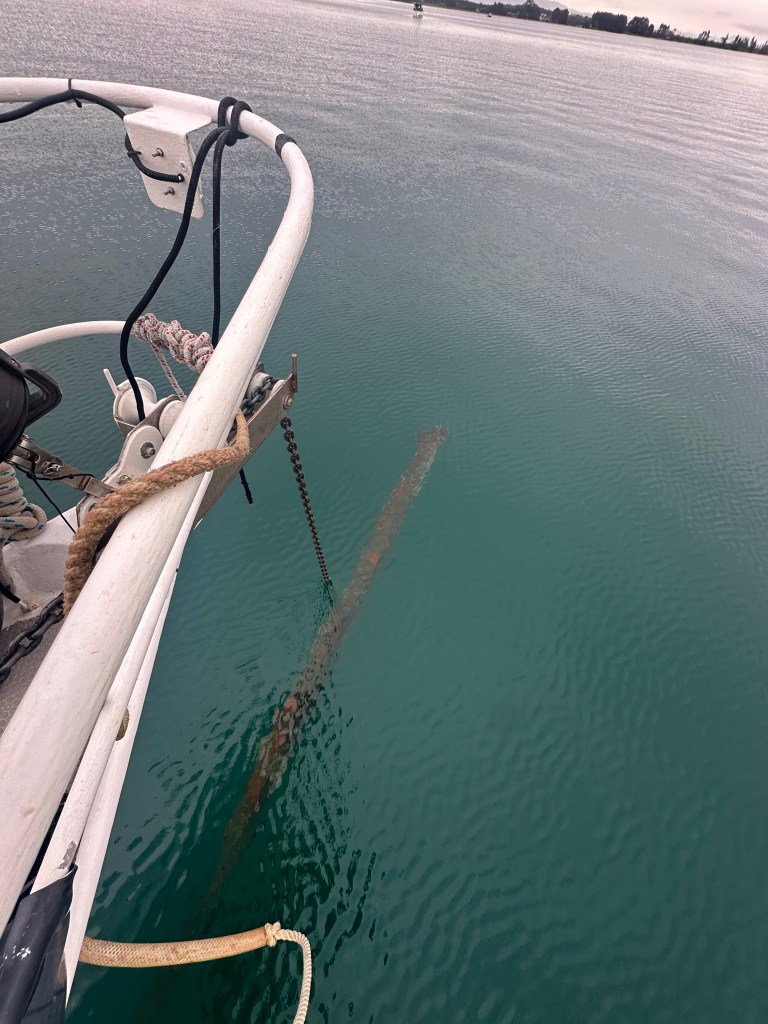
Rising late, we decided to see if we could find a spot closer to civilisation. We contacted both of the marinas in town, but their fees, about $70 a night, were a bit much for us to swallow, whilst efforts to find a mooring to rent were unsuccessful. However, the Harbour Master advised us that many people anchored amongst the moored boats in Pilot Bay. After clearing the tree we found wrapped up in our anchor chain, we drove across the harbour entrance and looked for a decent space in the boats around us. The problem with anchoring in a mooring field is that anchors, to some extent, hold by the weight of the chain let out. The minimum ratio in good weather (for chain) is 3:1, so in a depth of about 7.5 metres, adding the height of Taurus’ freeboard, we were looking at letting out nearly 30 metres of chain. A moored boat, in contrast, has a short length of chain attached to a heavy block of concrete – the unmoving block sunk into the mud doesn’t need the extra weight of chain to hold the boat in place. As the current changes and the wind shifts a boat swinging on a 30 metre chain will naturally move much further than a boat on say 10 metres of chain, so the risk of collision is very real and demands close attention.

After moving a couple of times and working out where other anchored yachts were we found a decent spot and were able to kind of relax. A dinghy ride to town earned us a dinner of fish and chips and the next day we caught up with old friends, Tony, Elena, and their boys: Alex and Martin, who took us to a Chinese food festival.
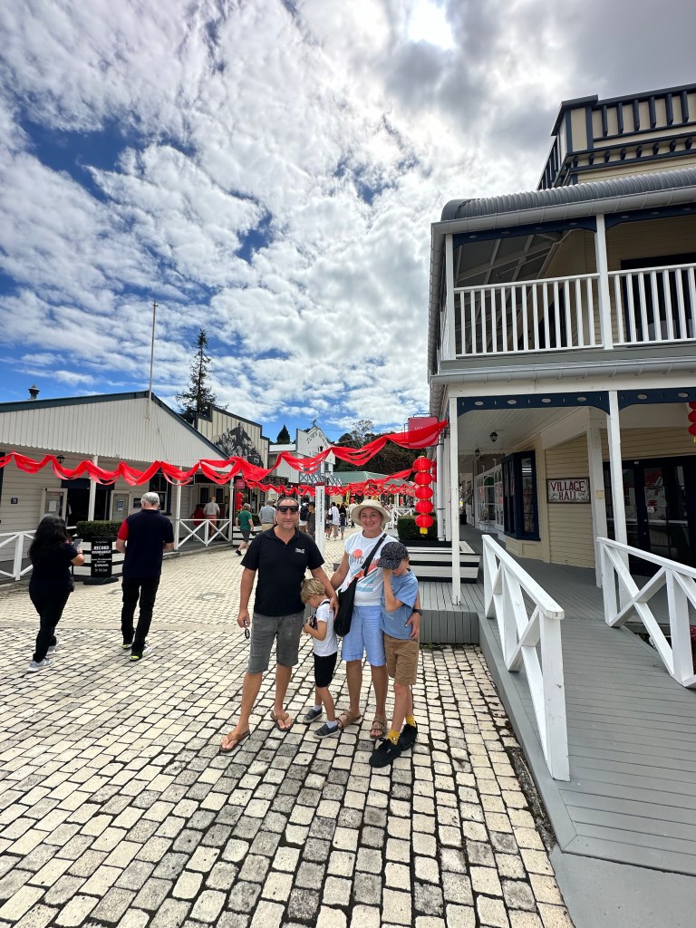
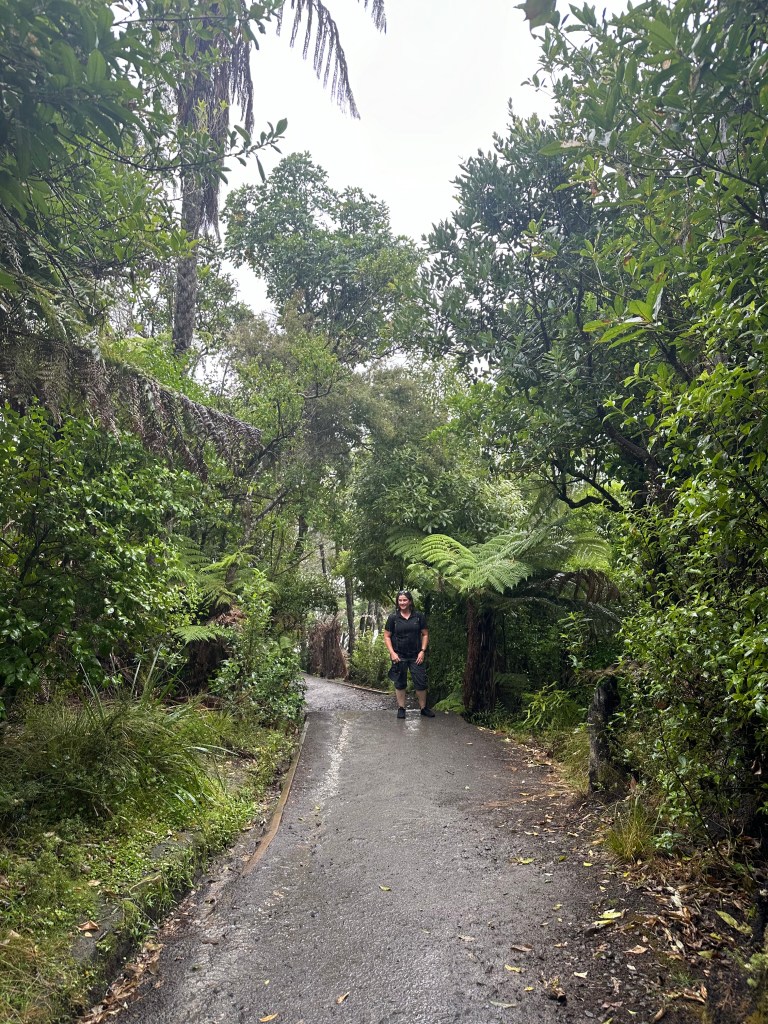
The following day we had coffee with friends from Dunedin who also happened to be in Tauranga, Doug and Nicky Third. After brunch we decided to climb Mount Maunganui and got caught out in a monsoon like downpour. Despite the rain it was far too hot to put on jackets so we settled for getting soaked! From the top we were treated to amazing views of low cloud.
We have now been in Tauranga for four days and hope to leave tomorrow, Tuesday, when another window of light southerlies will, hopefully, allow us to sail north. Having managed to get a fair distance towards our goal of arriving in the Bay of Islands by late April we are hoping to enjoy some day sails. Quiet anchorages and out of the way spots are calling, but just over the horizon lies Auckland where we look forward to catching up with more friends and relatives, and making some last minute preparations for the trip to Tonga.

Leave a comment